

Dickerson Pike Public Life Study
By Allie Miller, Design Intern
10 minute read Partnering with Walk Bike Nashville, and made possible with a grant from the Tennessee Department of Health, the Civic Design Center conducted a Public Life Study on June 21st to learn more about pedestrian behaviors on Dickerson Pike. Dickerson Pike is one of the most dangerous streets in Nashville for pedestrian traffic due to a lack of sidewalks, crosswalks, adequate lighting, and walk signals. The Non-Motorized Risk on Dickerson Pike Blog provides more details on the lack of pedestrian safety. The public life study results show 582+ pedestrians in the area engaging with the public space that is almost entirely the street.
Conducting the Public Life Study
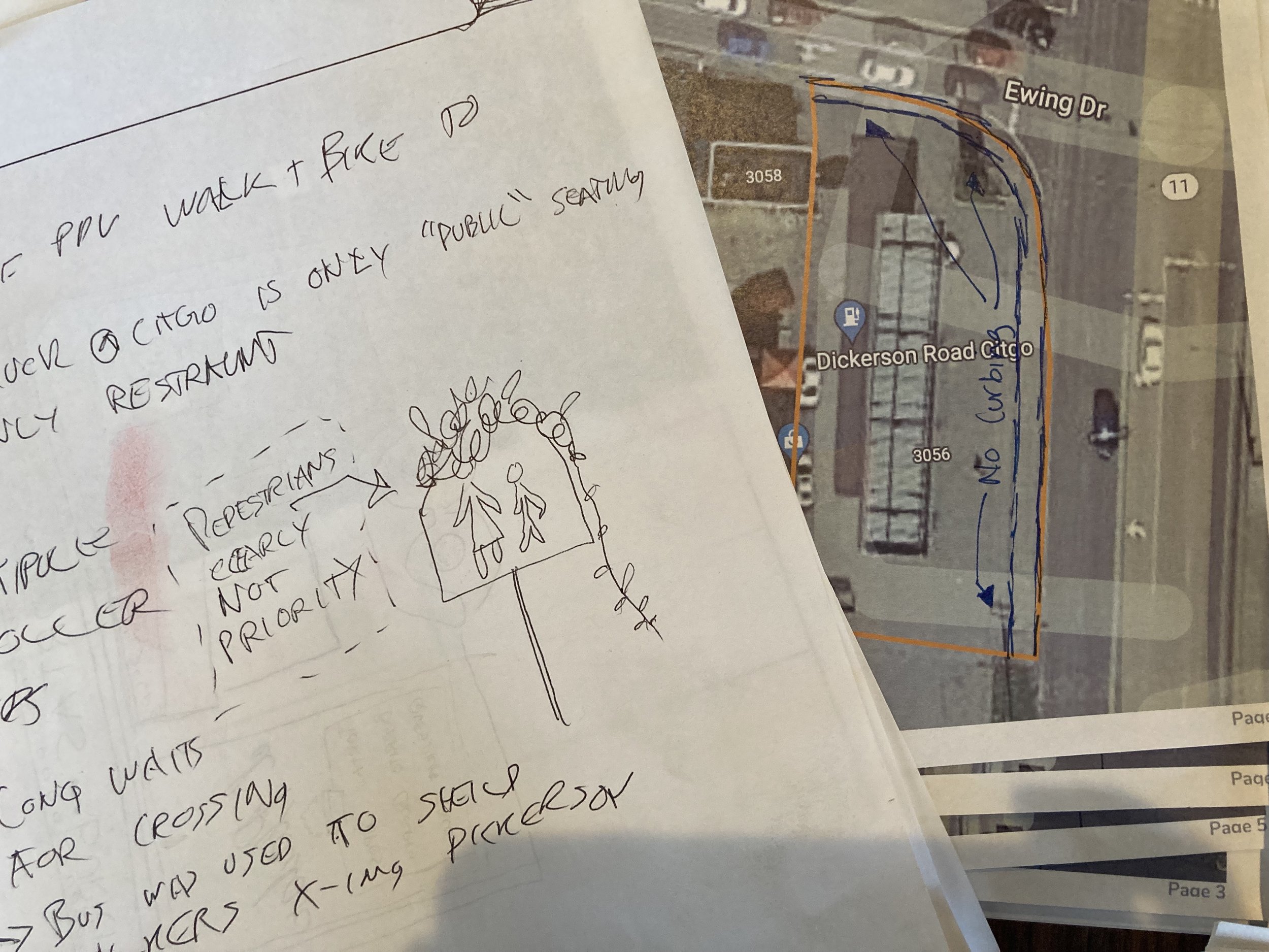
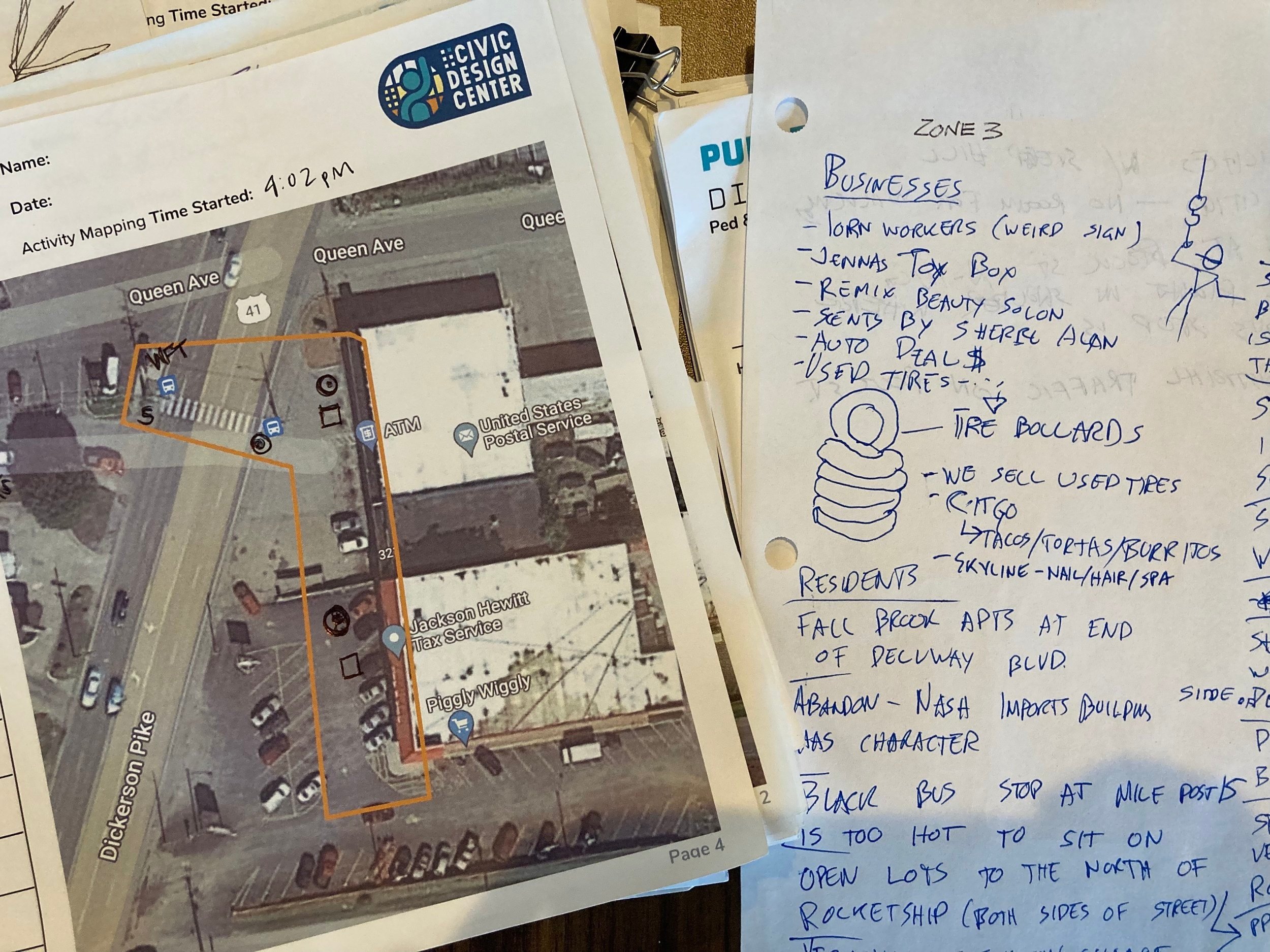
Images of the paper notes taken during the public life study
This Public Life Study focuses on four different zones along a 1.7-mile stretch of Dickerson Pike. For this study, Zone 1 is located at the intersection of Dickerson Pike and Ewing Drive/Broadmoor Drive. Zone 2 is located at the intersection of Hart Lane. Zone 3 is located at the intersection of Rock Street near Rocketship Elementary school. Zone 4 is located at the intersection of Queen Ave near the post office. The graphics below show the location of each zone with existing sidewalks, transit stops, signals, and schools in the area.
The study observed the pedestrians in each zone in 10-minute increments. The first observation period counted the total number of pedestrians and cyclists in the first of two locations in the given zone. For the next 10-minutes, we repeated this count in the second location. Then, the count focused on tracking the approximate age and gender of the pedestrians in the area. Finally, the activities of pedestrians were mapped and counted. These counts were repeated four times to have data from each hour between 3 & 4pm, 4 & 5pm, 5 & 6pm, 6 & 7pm approximately.

Dickerson Pike map and diagram showing the breakdown of people active in each zone at each hour.
pedestrians on Dickerson pike
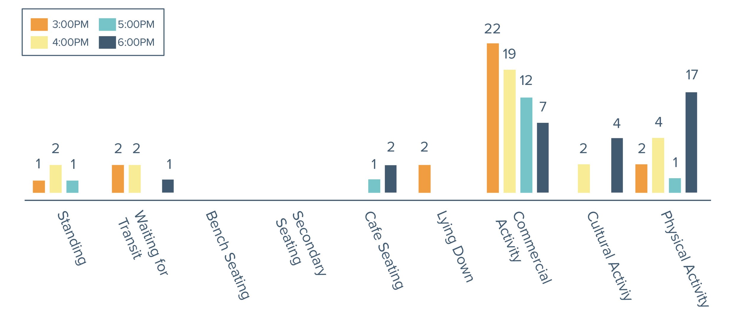
Between all four of the zones, 582 pedestrians were out and about on Dickerson Pike primarily engaging in commercial activities. These pedestrians were primarily male and older adults and there were few cyclists in the area. The graphics below showcase when cyclists and pedestrians used each zone, as well as age and gender counts, and activity counts.

Approximate location of pedestrians and cyclists counted by hour in each zone along with notable findings at each location.
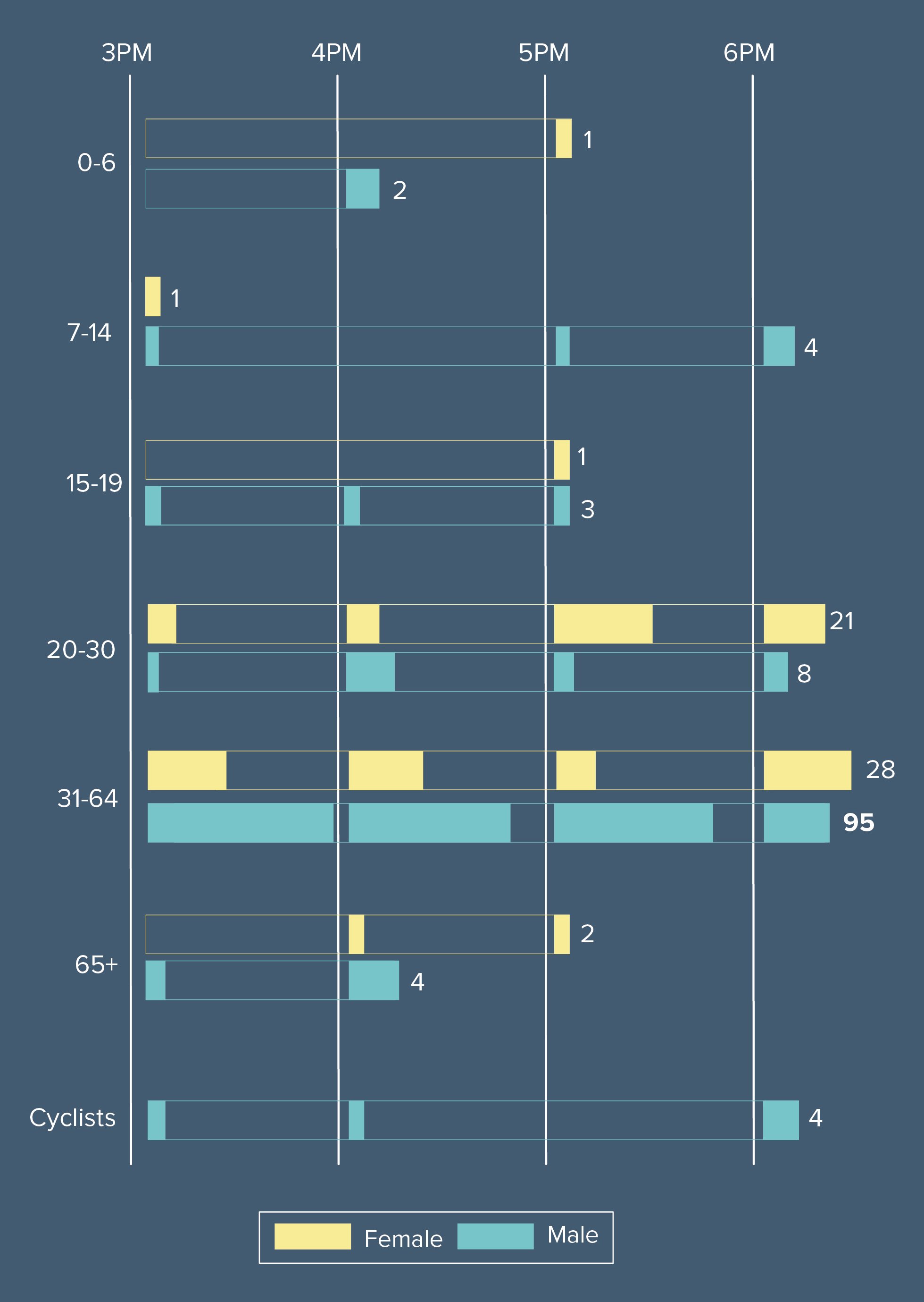
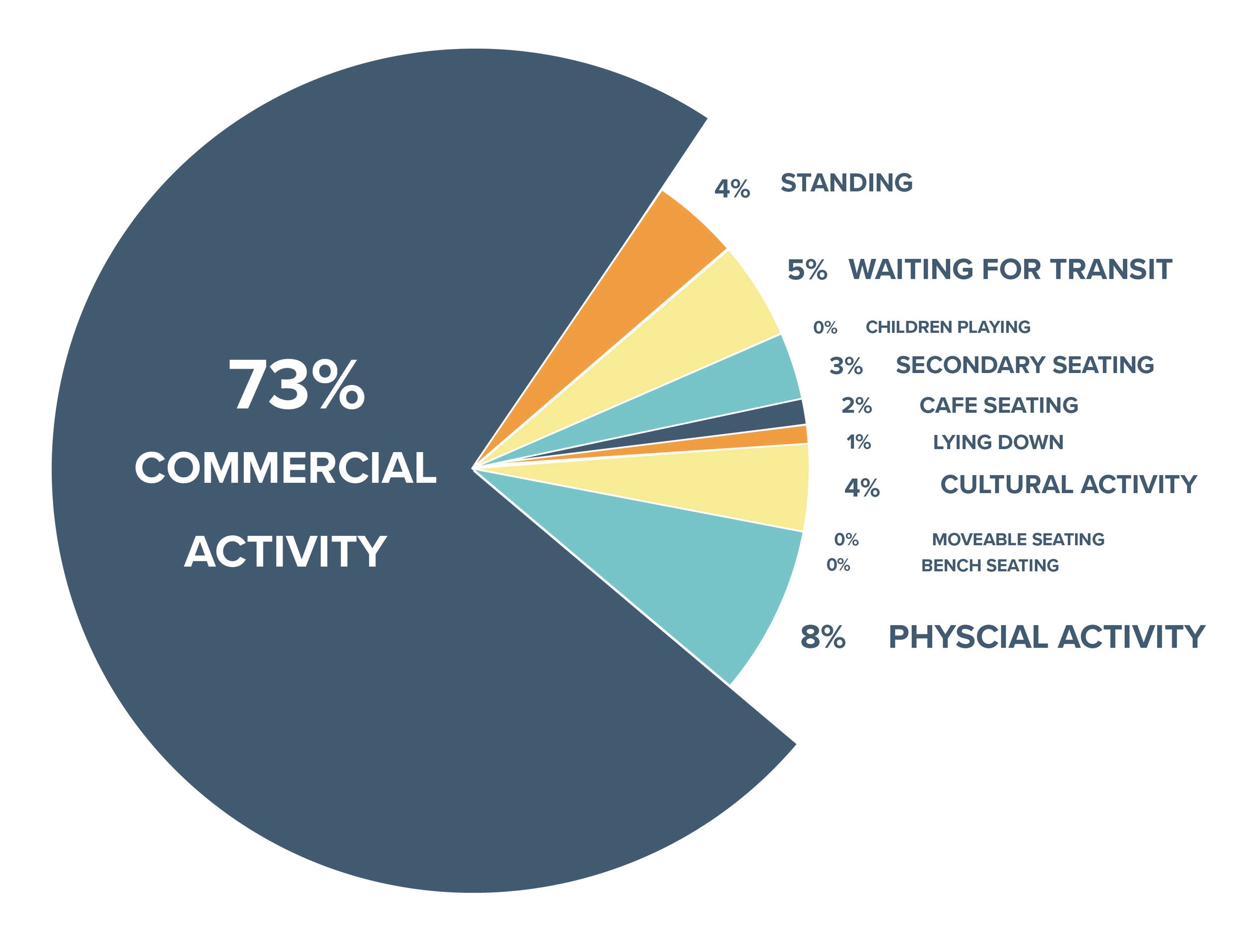
The age and gender count per hour in all zones with the total of each category (left). The percentage of activity mapped in all four zones and all four hours (right).
Dickerson Pike + Ewing Drive: zone 1
The intersection of Dickerson Pk, Ewing Dr, and Broadmoor Dr lacks pedestrian crossing buttons, sidewalks, curbs, green space, public seating, accessibility, and shade. The vehicles drive too fast and make sharp turns onto Broadmoor. The slip lane, with a slanted low visibility yield sign, makes a tricky crossing for pedestrians into the crosswalk due to the high speed of cars turning through the lane. Multiple cars were seen skipping lights by cutting through the CITGO parking lot to avoid the intersection. The only public space in this area is the street, making it difficult for pedestrians to use this zone. The bus stop provides no seating or shade for those waiting for transit.
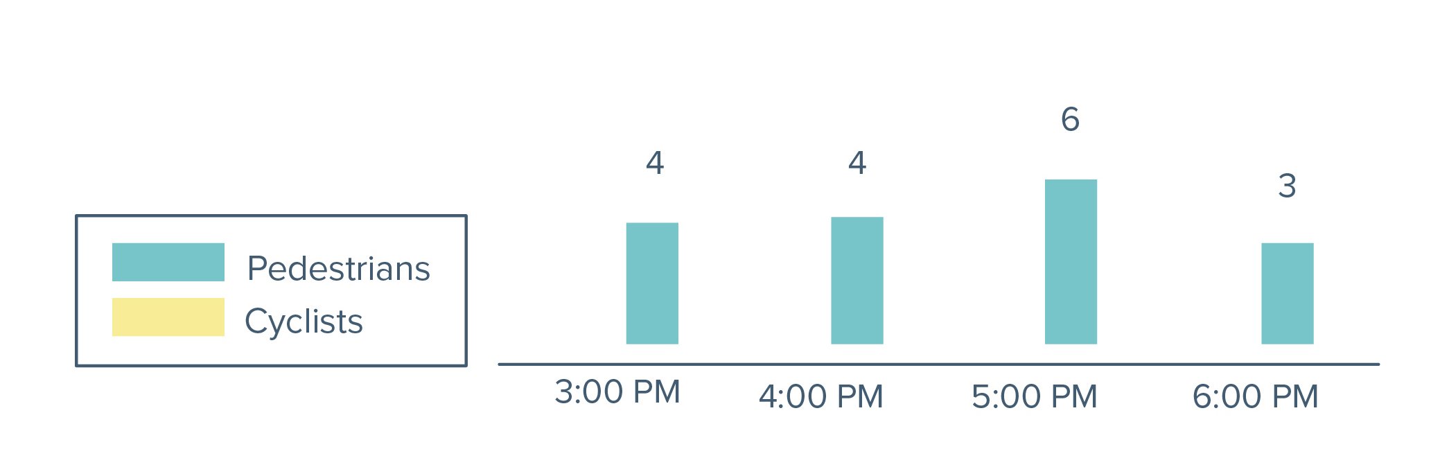
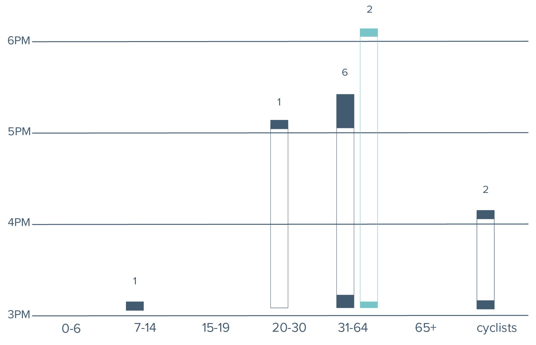
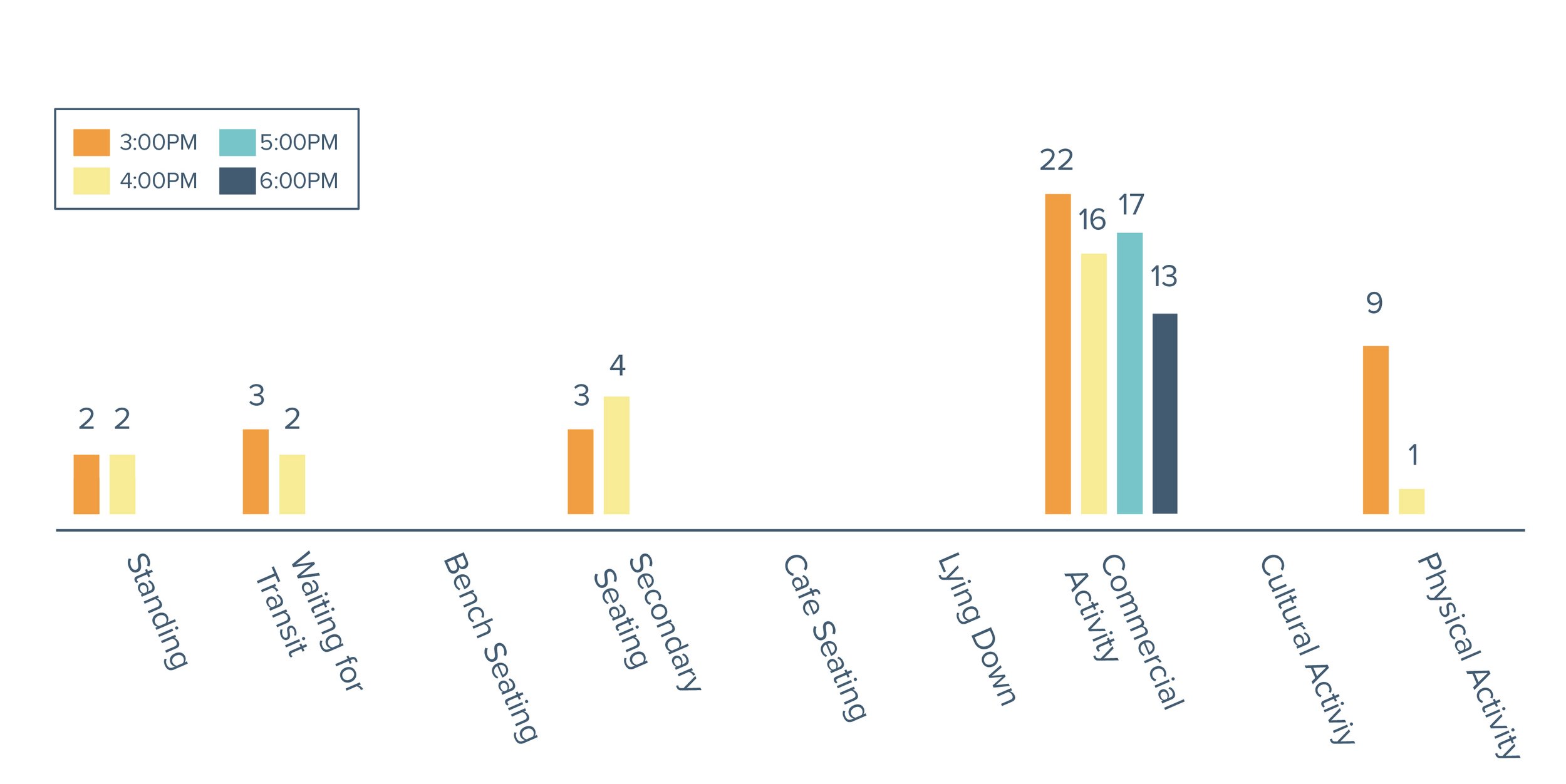
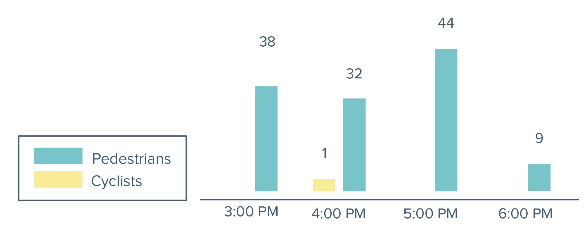
The count of pedestrians and cyclists in this zone were consistent, dropping slightly during the later hour count. Older adult males were seen more frequently, then middle-aged adults and a few younger males. Activities varied in this zone but a majority of the pedestrians were commercial traffic. Pedestrians were also seen standing, waiting for transit, sitting, and participating in physical and cultural activities.
Activity mapping count by hour (left). Pedestrian and cycle count by hour (middle). Age and gender count by hour (right).
ZONE 1 DESIGN INTERVENTIONS
Potential TURBO intervention at Ewing Drive: Introducing bulb-outs could reduce vehicular speeds turning as well as create safer pedestrian zones near crosswalks. Including public art in the middle of the intersection can provide traffic calming.

Idealized permanent installation at Ewing Drive: Creating a raised intersection with appropriate crosswalks and ADA-compliant curb cuts would create an accessible pedestrian-friendly intersection. Traffic calming could occur from the removal of the slip lane and landscaped bulb-outs. An old gas station structure currently used for parking could provide a shaded outdoor space with seating for pedestrians.
Dickerson Pike + Hart Lane: Zone 2
The Hart Ln intersection is pedestrian quiet and has minimal cyclists who both use the sidewalk. The liquor store generated the most pedestrian traffic with a few pedestrians going to the pawn shop. The traffic light is working but vehicles are still confused due to high levels of pull in and pull outs that disrupt the flow near the intersection.
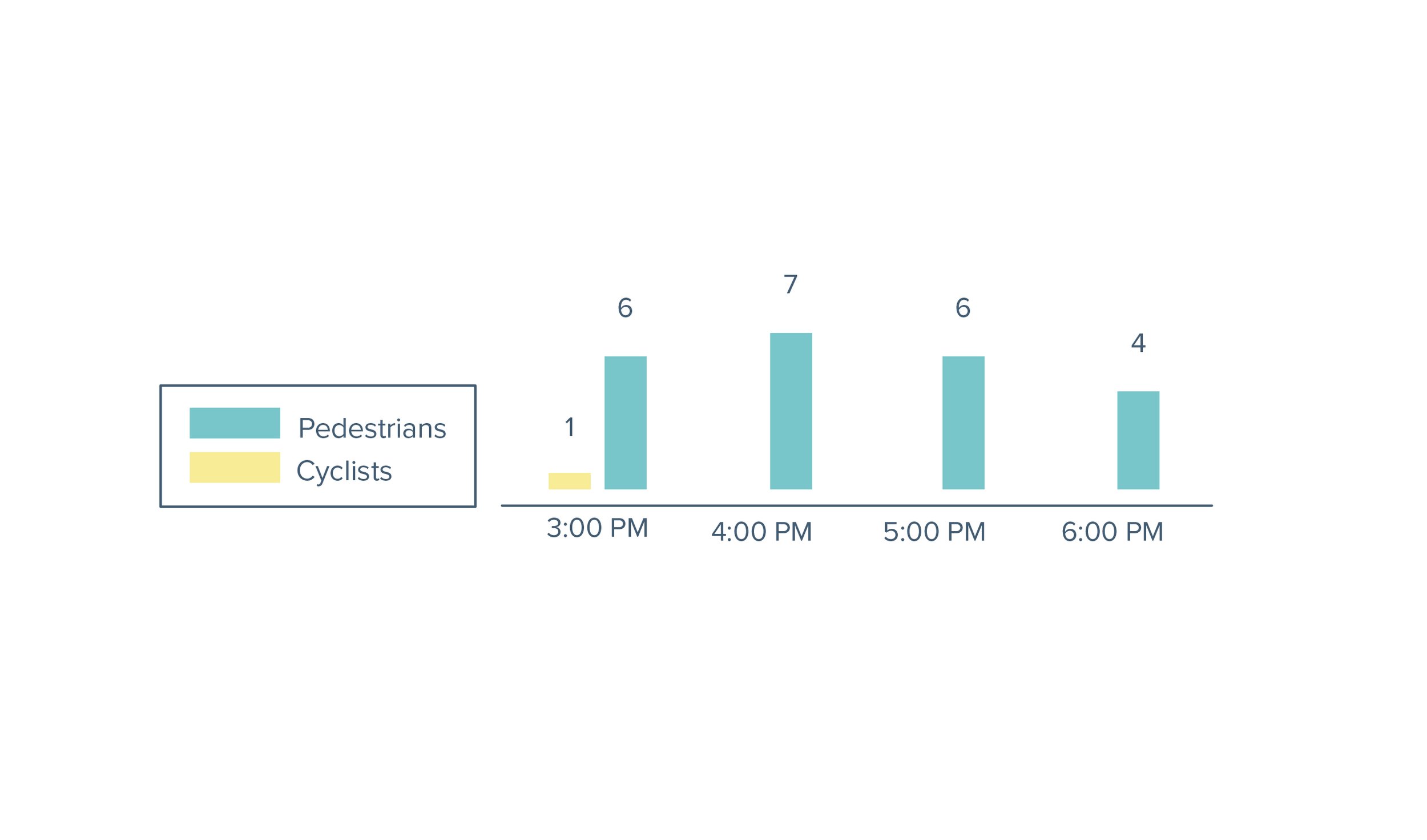
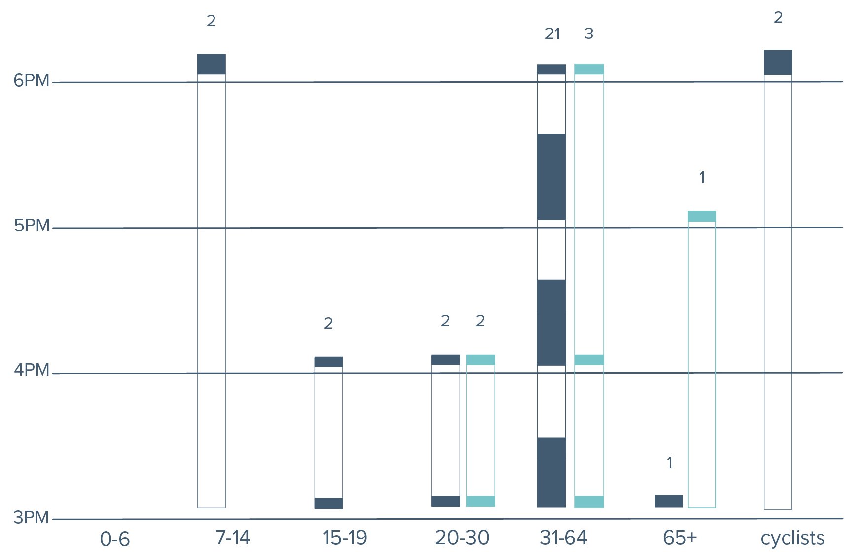
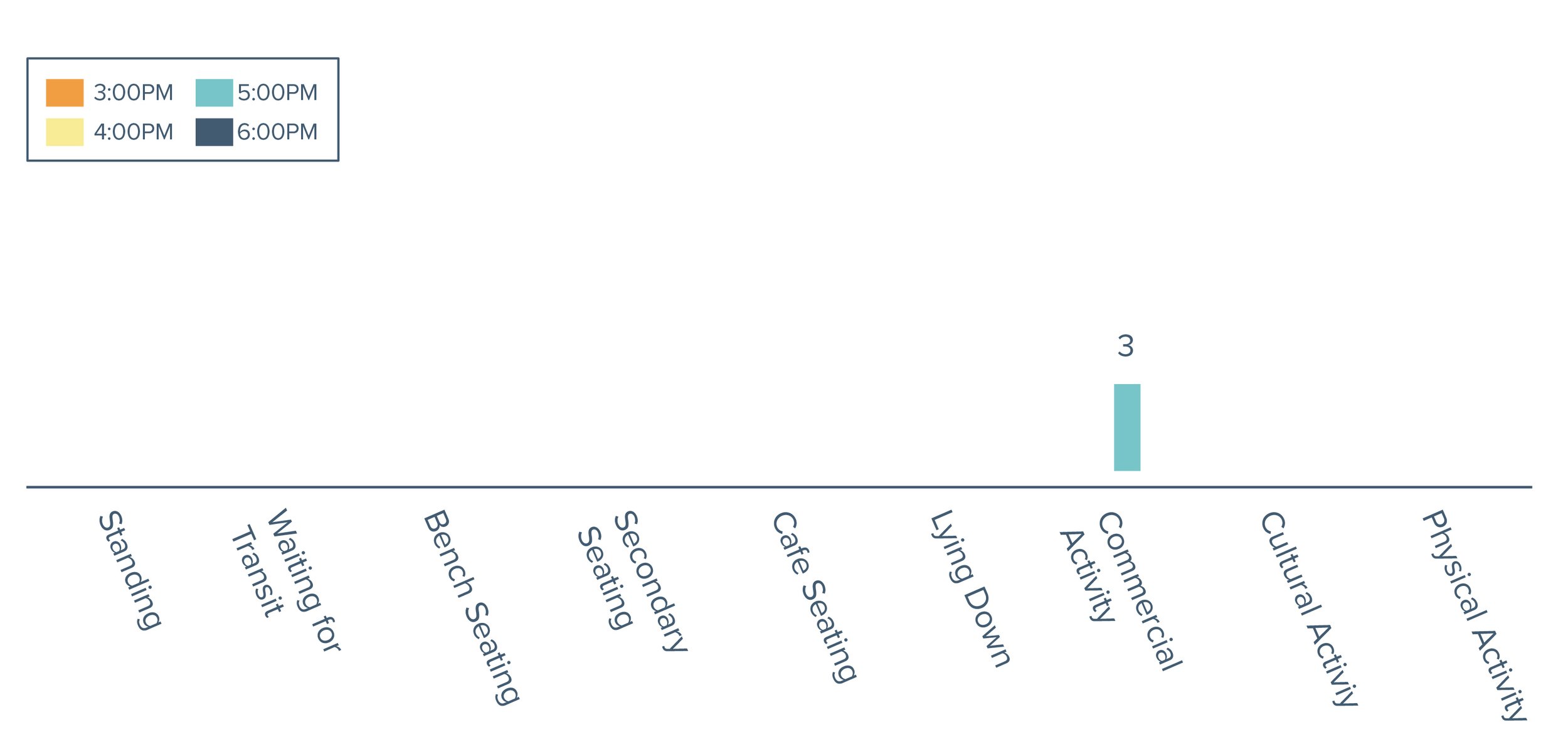
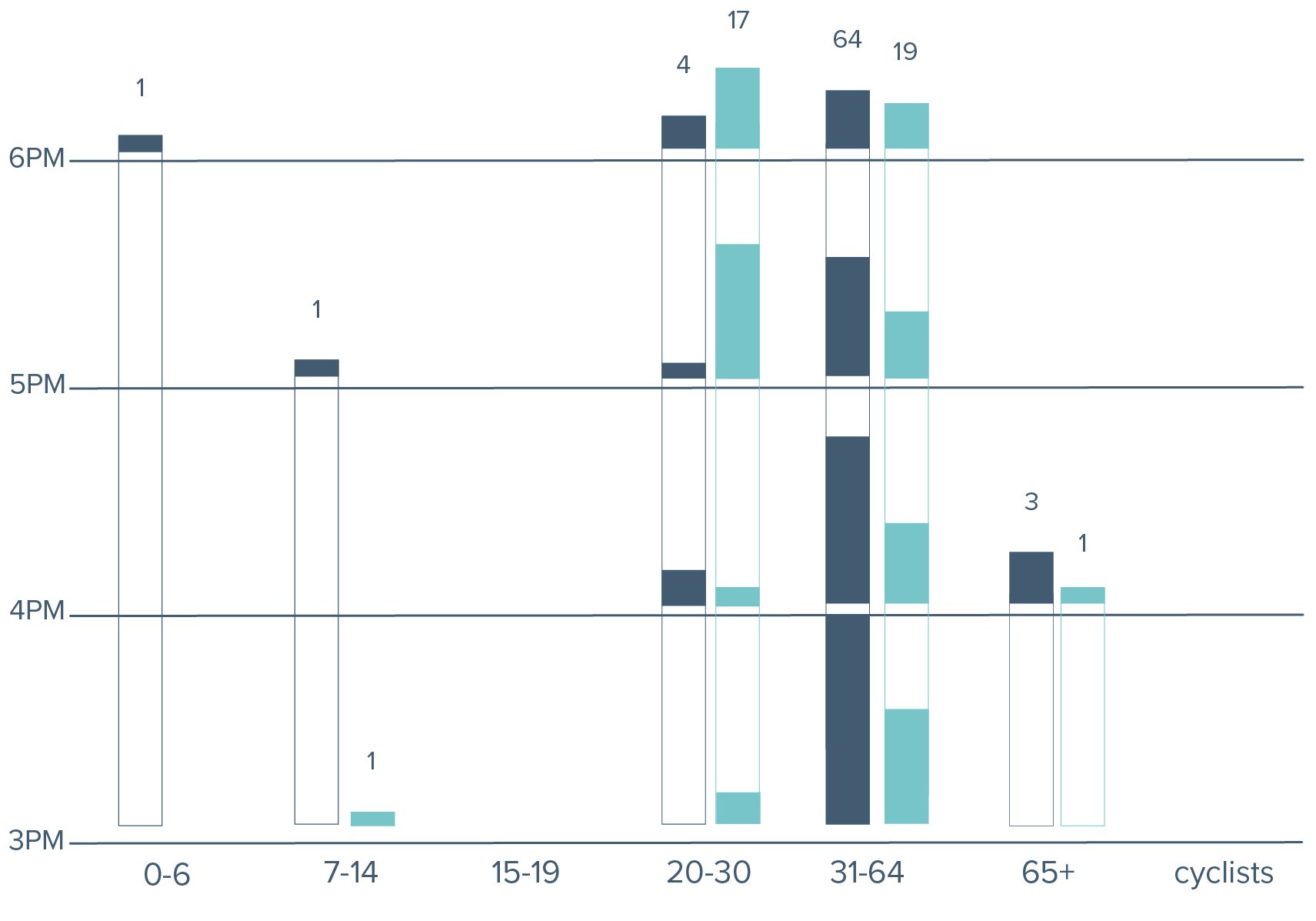
The count of people was consistent throughout the count with the most being seen between 5pm and 6pm. There were similar numbers of middle to older adults as well as a few younger children. The majority of activity counted in this zone was in the commercial locations and there were some secondary seating in the grass in between counting times.
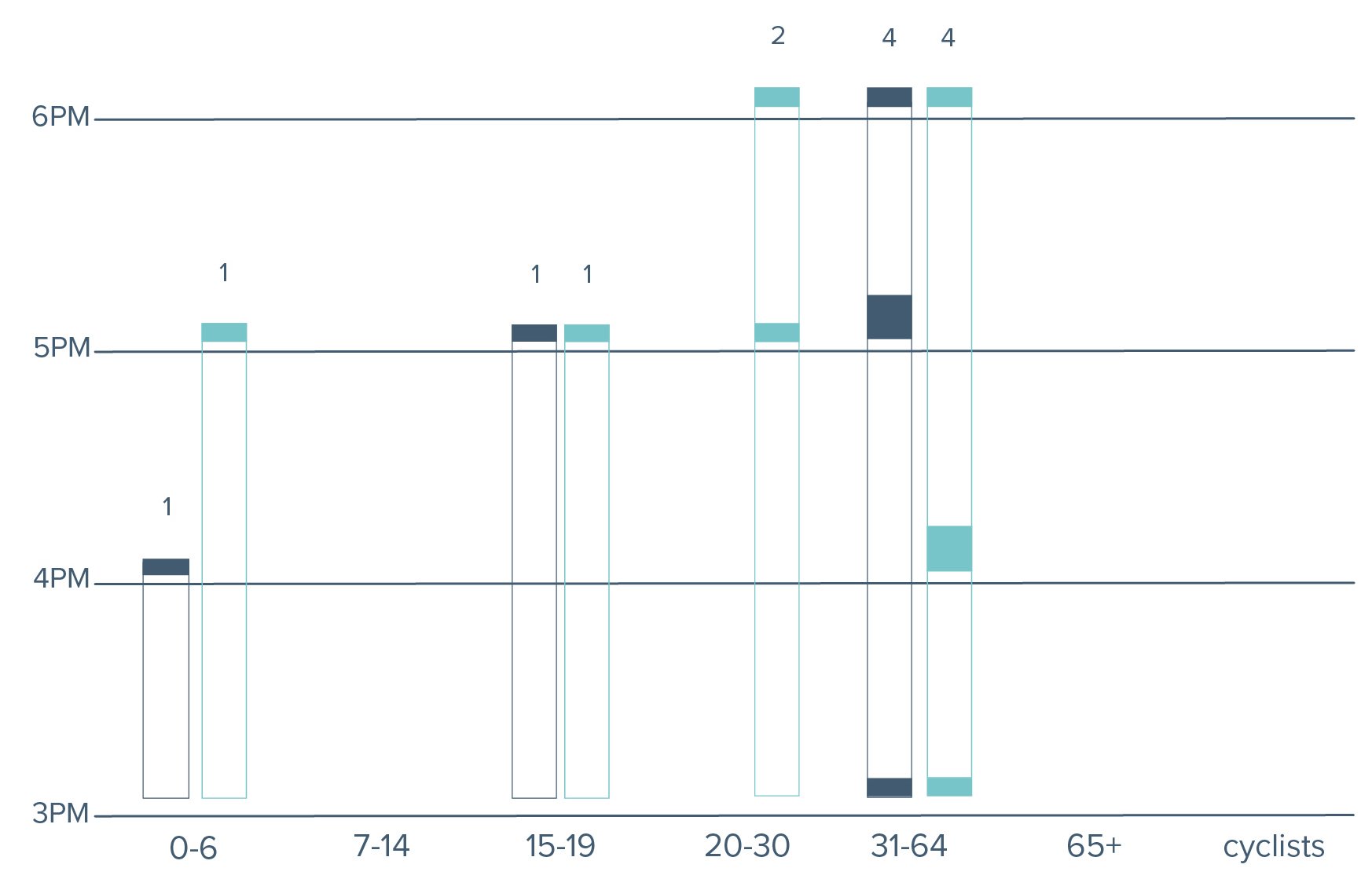
Activity mapping count by hour (left). Pedestrian and cycle count by hour (middle). Age and gender count by hour (right).
ZONE 2 DESIGN INTERVENTIONS
TURBO Intervention at Hart Ln: See how Nashville’s Youth Designing Its Streets implemented interventions at this intersection. Repainting the NYDT installation could continue to reduce turning speeds and drawing attention to the eye catching designs in the bulb outs.

Idealized permanent installation at Hart Ln: A traffic calming circle could provide direction to vehicles through painted pavement way finding as well as reduce speeds traveling through. Installation of an art piece, updated crosswalks, and landscaped sidewalks would create place for pedestrians. (This graphic is a representation of an idea for calming is not accurate to a
Dickerson Pike + Rocketship: Zone 3
The Rocketship intersection looks at Rock Street and Dellway Villa Road. The speed through this intersection is very fast and vehicles often drive on the shoulder. Rock street has a lot of industrial traffic while Dellway Villa Road has residential traffic coming from the Fallbrook Apartments. Rocketship has rapid flashing beacons for the school zone during school times. The only sidewalk is located in front of the school and the rest of the streets shoulders are not adequate for walking. Most people cross where the transit stop is instead of using the existing crosswalk. Pedestrian traffic is not a priority as a bus had to shield crossers from traffic in order to cross. Those involved with Rocketship say that they have crossing guard for the children’s safety during the year but they often worry for the safety of their crossing guard. There were multiple stroller users and long waiting times on either. Most pedestrians were coming to and from the Fallbrook Apartments. Cyclists rode opposite the traffic and many people were walking and biking to the CITGO up Dickerson to get groceries. No pedestrians went to the commercial area located south of this intersection.
There was little pedestrian traffic in the zone and few people in their commercial areas. The majority of pedestrians and cyclists were counted between 6pm and 7pm. The people in the area were observed to be older adults and primarily male with only 2 females seen during the counting. If counting occurred at an earlier time of day during the school year, these numbers may look vastly different.
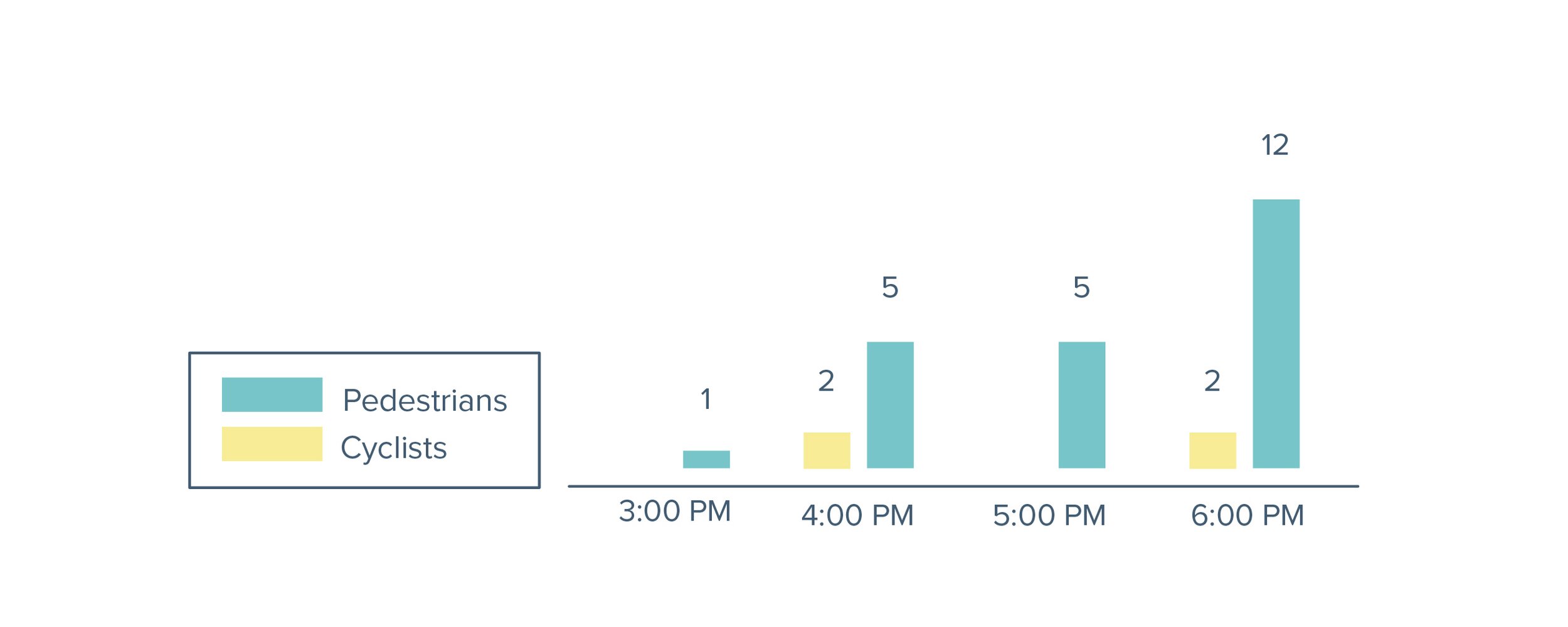
Activity mapping count by hour (left). Pedestrian and cycle count by hour (middle). Age and gender count by hour (right).
ZONE 3 DESIGN INTERVENTIONS
Potential TURBO Installation at Rocketship: Initial thoughts to reduce speeds as seen in Nashville’s Youth Designing Its Streets provides a pedestrian refuge and sidewalk area painted on. This would update the existing crosswalk by providing safer areas for pedestrians.

Idealized permanent installation at Rocketship: After TURBO installations, ideas about the placement of the crosswalk may change to reflect patterns found in the public life survey. Here it is placed equally between the two transit stops. Along with the landscaped sidewalks and refuge, a HAWK beacon could be installed on each side to ensure the safety of children and pedestrians crossing the street.
HAWK beacon (High-Intensity Activated crossWalK beacon)
Officially known as pedestrian hybrid beacon, this traffic control device provides a signal for vehicles to stop only when necessary for pedestrian crossings. The implementation of a HAWK beacon here would provide ample signaling to vehicles that a person is intending to cross the street, flashing a yellow to slow and red to stop for the pedestrians, similar to a typical traffic light. When there is no pedestrian activation the beacon remains off. See sequence below:

Dickerson Pike + Queen Avenue: Zone 4
Car traffic is fast and chaotic at this intersection. The staff zone, USPS, Piggly Wiggly and other stores are all open to the street with no traffic flow built in through curbs or sidewalks. Sonic is the only area with curbs, shade, and seating. Cars often did not stop for pedestrians in the crosswalk, whizzing by in the next lane over. Multiple people waited for the bus underneath a tree on the other side of Grizzard Avenue because the transit stop structure provided no shade. Grizzard Avenue had steady vehicular traffic in and out due. Staff Zone had a large number of older male adults using their facility and leaving by bus or van pick up. Many pedestrians went back and forth from the bus stop to the grocery store, liquor store, and Sonic to get snacks and drinks. Informal seating on curbs and in shaded grassy areas were the primary sitting places. The sidewalks on the side streets stop at Dickerson and the shoulders are too small to safely walk on, although many people walked through the area this way.
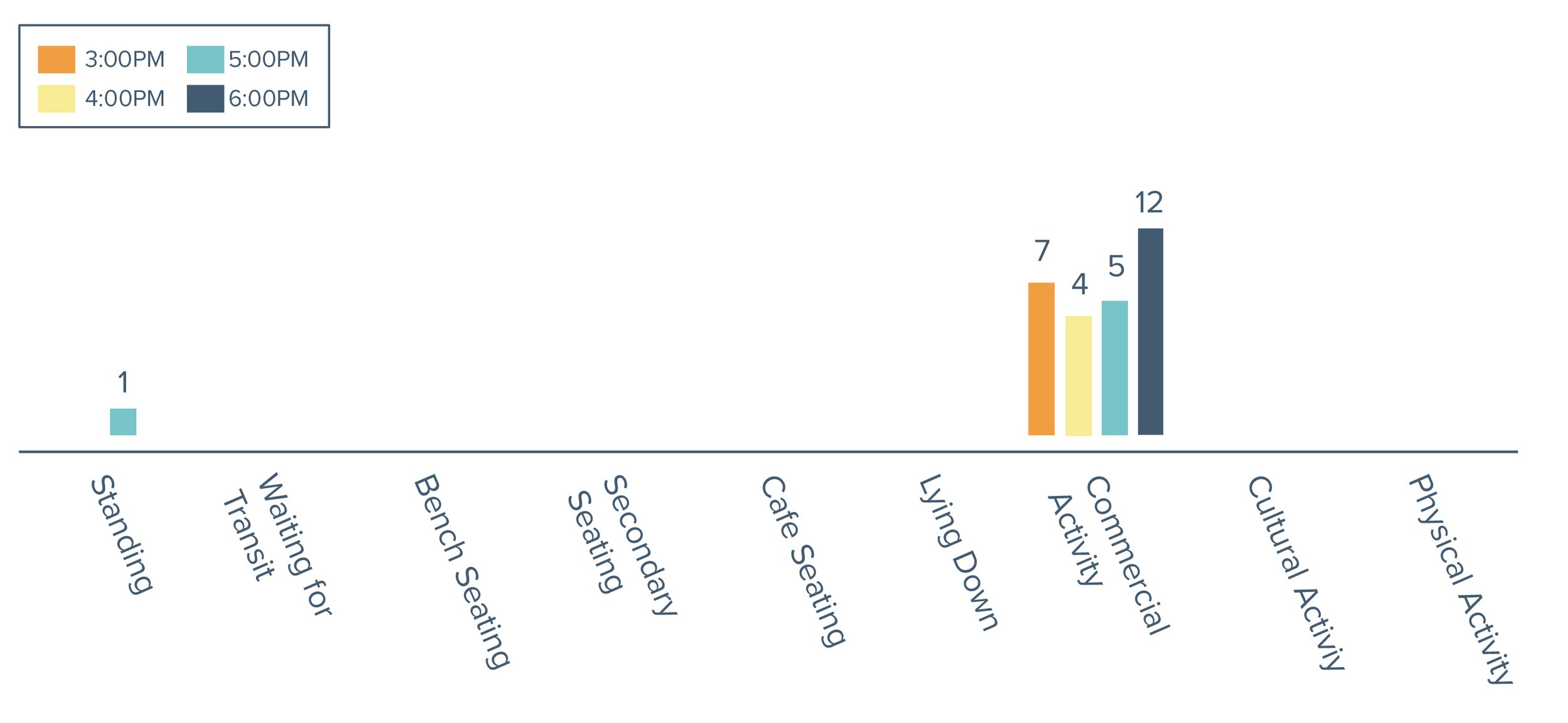
The majority of pedestrians were near the commercial areas. Consistent vehicles and pedestrians approached the Piggly Wiggly, USPS, Liquor Store, Staff Zone, and Sonic during the entire count. While some people were engaging in physical activity passing through, most pedestrians were standing outside of commercial space, waiting for transit, or finding a secondary seat in the shade or on a curb. The commercial activity in this area, especially the staff zone, was the greatest attribute to the high number of pedestrians. Pedestrians in this space were primarily older men from the ages of 31-64. Very few children and young people were in the area. The number of pedestrians was consistent from 3 pm-6 pm from 32-44 people and dropped off until the end of the counting at 7 pm to only 9 people.
Activity mapping count by hour (left). Pedestrian and cycle count by hour (middle). Age and gender count by hour (right).
ZONE 4 DESIGN INTERVENTIONS
Potential TURBO Installation at Queen Avenue: A ground mural on either side of the crosswalk would provide something to look at and encourage cars to slow down approaching the crosswalk area. Painting the shoulder would provide a pedestrian focused area and could strategically place openings for cars into the businesses to regulate the traffic flow.

Idealized permanent installation at Queen Avenue: A raised intersection here as well as sidewalk structure could allow for a signalized and more controlled intersection. Vehicle traffic would have more wayfinding into parking lots through main entrances and landscaping could allow for shade. Pedestrians would be able to cross and wait for transit in a safer setting.