
Centering Corridors: 2 Simple Ideas for right now
By Kaitlin Dastugue, Chief Operating Officer
5 min read Proposing placing major corridors at the center of Metro Council districts and proactively upzoning those corridors for dense mixed-use housing are easy wins that could solve some administrative hurdles.
Summer is coming to a close, and with budget season long behind us—both at Metro Council and in my lane here at the Civic Design Center—I've been thinking about what practical progress could look like over the next few months to get us closer to the vision of a beautiful and functional city for all.
For the kick-off of our 25th Anniversary year, we hosted an event called “Leading the Now” with the intention of considering how we can use the near future to guide how we act NOW as the city grows and develops at a sprinting pace. Below are two ideas for policy changes our city leaders could implement rather quickly, while making a huge impact.
Idea #1: major corridors should be centerpieces of our local political districts, not the dividing lines
Nashvillians didn’t choose to shrink the size of our Metro Council and Metro certainly isn’t thinking about how to redraw our Council Districts for fun. But since this exercise will likely happen anyway, we shouldn't waste the opportunity to make our districts function better. One simple principle should guide our mapmakers: our major corridors should sit at the center of Council districts, not form the boundaries between them. When a corridor forms the boundary between two districts, every intersection, major street redesign, or tactical urbanism project becomes a shared political responsibility between multiple Councilmembers. That's difficult under Tennessee's open meetings laws which make informal coordination between elected officials complicated. Below are two examples of this pattern. Main Street and Gallatin serve as the dividing line between Districts 5 & 6 and a key stretch of Clarksville Pike incorporates Council districts 1, 2 & 21.
Planning department maps from the 2023 redistricting exercise were on the right track– they tried to avoid our major corridors as dividing lines between districts. As the court ruling is expected “any day now,” my hope is that mapmakers will keep this principle in the forefront.
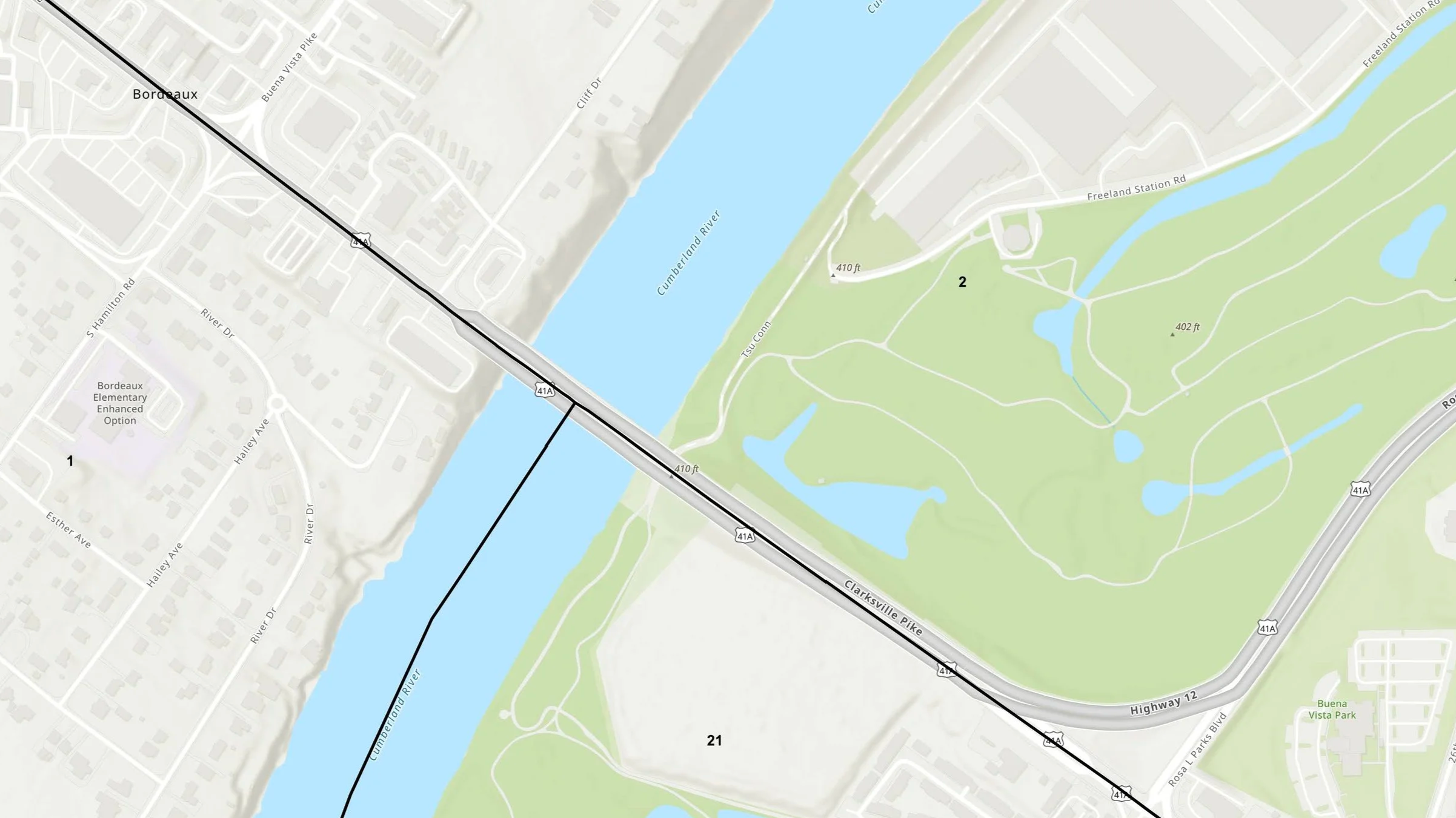
Map of Bordeaux split by council district lines on Clarksville Pike
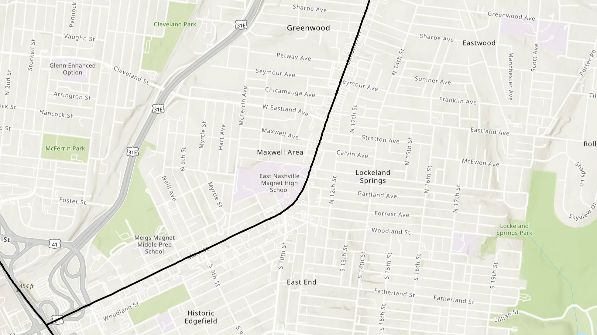
Map of East Nashville split by council district lines on Main St and Gallatin Pike
Idea #2: Let’s upzone our corridors already!
NashvilleNext, adopted in 2015 as the city's comprehensive plan, calls for higher-density housing along major corridors and around neighborhood centers, with appropriate transitions into surrounding neighborhoods. Over the past decade, public support for adding housing along these corridors has only grown as Nashville's housing shortage has reached crisis levels.
But policy isn't zoning. While NashvilleNext sets the vision, only Metro Council can update the zoning to make that vision possible. Today, most corridor rezonings happen one parcel at a time, requiring lengthy public processes and debates over what is allowed for each individual property.
At the most recent Housing Matters symposium at Belmont, I heard about the painstaking rezoning process an affordable housing developer navigated just to build a mixed-use project which incorporates affordable, artist housing with a child care center on Dickerson Pike. Affordable housing (with childcare!) on a transit corridor is exactly what our adopted plans, and Nashvillians, continue calling for. We shouldn't be making projects like that any harder than they already are.
Instead of parcel-by-parcel rezonings, Metro Council could proactively rezone every property along our major corridors to a zoning category that actually allows for the mixed-use, dense development we desire (the zoning category, MUG, has been a popular suggestion in my own household). It would have the potential to increase our housing supply now, provide more certainty for residents and developers alike, and get our corridors housing-ready before the major transportation investments from Choose How You Move begin, ensuring riders are there and ready to utilize our new transit infrastructure. Other tools like TOD Redevelopment Districts and Urban Design Overlays (UD’s) can come along at their own pace to provide a finer-grain, form-based guidelines that respond to unique charactistics of each segment.
The bigger question is: what should that corridor zoning district be? MUG? Something different? Share your thoughts in the comments.
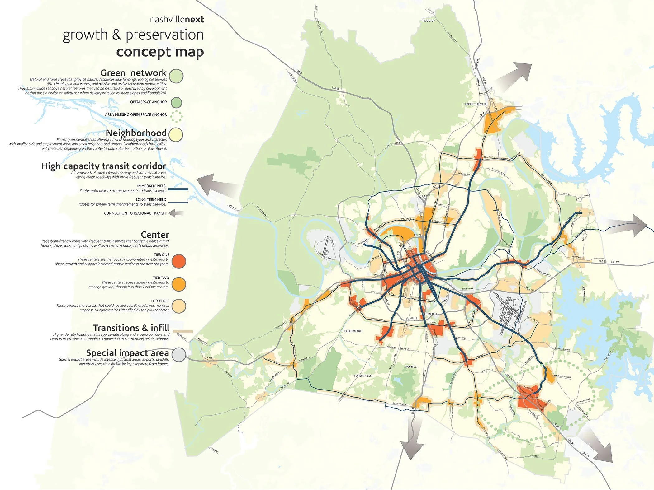
Nashville Next Growth & Preservation Map
While these ideas aren’t revolutionary, they are timely. It’s the perfect time to consider these kind of moves that help us “set the table” for the transformative investments coming up the proverbial (and literal) pike.