

Non-Motorized Risk on Dickerson Rd
15 min watch / 3 min read - GNRC presented their Non-Motorized Risk Index at the February Safe Dickerson Steering Committee meeting led by Walk Bike Nashville and the Civic Design Center. The index looks at identifying areas where risk is disproportionately high along roadways. GNRC examined the Committee's 1.7-mile segment focus area on Dickerson Pike between Trinity Ln to Ewing Dr.
GNRC's Corridor Summary:The street view above depicts a section just north of Hart Lane, facing north towards Ewing Drive.

Source: TDOS (2015-2019) Titan/TRIMS/TDM
Segment Highlights (1.7 miles):
Number of Lanes: 4
Speed Limit: 40 mph
Functional Classification: Urban Other Principal Arterial
Traffic Signals Present: Yes
Transit: 23 stops in close proximity
Education: 3 schools in close proximity; Rocketship Nashville Northeast Elementary, Jere Baxter Middle, and Tom Joy Elementary
Non-Motorized Facilities: Sidewalks are present, but sidewalks have connectivity issues. This segment is a signed shared route for bicyclists.
Congestion: moderately congested area (45% FF)
Volume: expected to increase by 38% between now and 2045
Vulnerable Populations: 9 out of 9; Elderly, Single Mother Households, Unemployed, Carless, Ethnic Minority, Racial Minority, Poverty, Limited English, Disabled
Latent Demand measures where there is demand for walking and bicycling facilities in the Nashville region. It is quartiled into lowest, low, high, and highest. Demand varies between high and highest along this corridor.
Crashes 2015-2019: The segment is in a top 10% of regional high-crash areas. There have been over 450 total crashes. Of those crashes, 16 resulted in a serious injury and one resulted in a fatality. There have been 7 non-motorist serious injury crashes and one fatal pedestrian crash. Some areas within this segment of the corridor are in the Top 25% worst areas for non-motorists.
Regional Significance:
The hotspot locations within this segment are Trinity Lane and Dickerson Pike, and Ewing Drive and Dickerson Pike. These two intersections account for about 1/3rd of total crashes along the corridor. There are 56.24 total crashes per mile, per year on this segment, about 5 times the regional average (11.81) and about twice that of Davidson County (24.94).
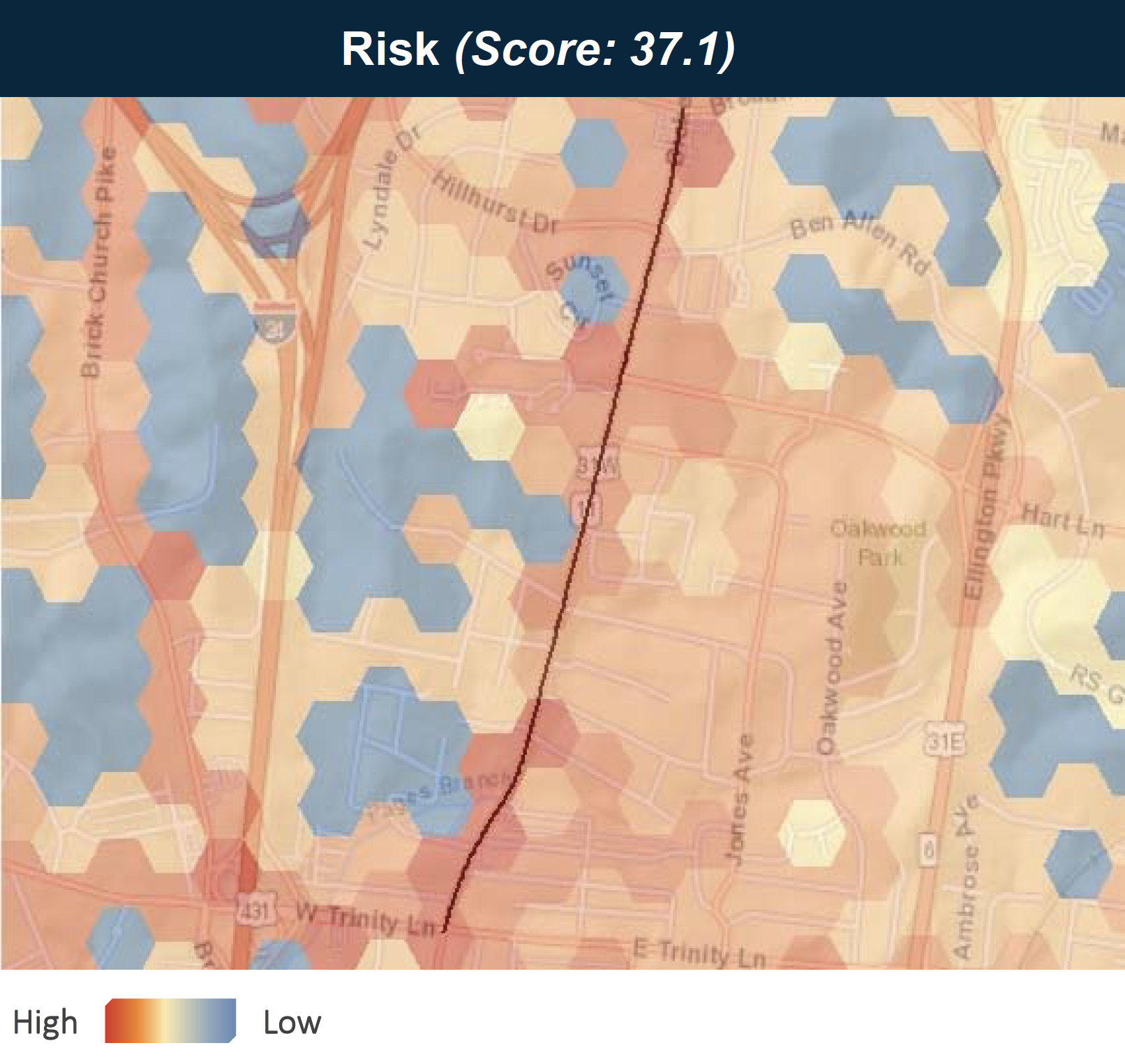
Risk Score
This corridor is in an area with high demand, is a regional crash hotspot, and is high risk. The non‐motorized risk score indicates areas where the odds of a bicycle or pedestrian crash occurring are disproportionately high based on crash risk factors related to the built environment, trip origin and destination, and travel behavior.
Areas with higher risk are indicated in red. While only a few areas along the segment have a significant crash history, as shown in the hotspot map, the entire segment is high risk. Compared to the rest of the region, this segment is among the highest risk locations across the region and has a similar risk score to areas along Nolensville Pike and Harding Pike.
Help Us Make Dickerson Rd Safer