
Gateways to Greenways
Most Recent Update
2026Focus Area
Parks + Greenways

Partners
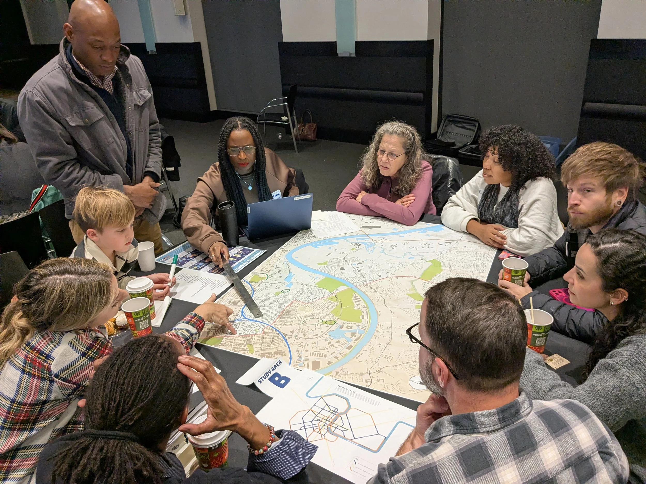
Using Streets to Connect Greenways
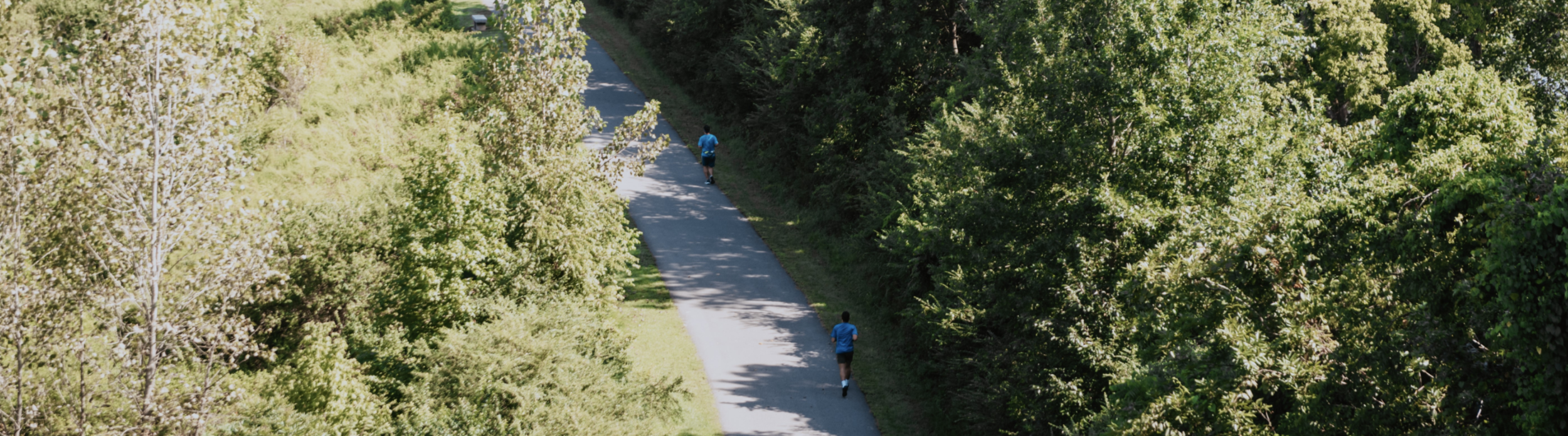
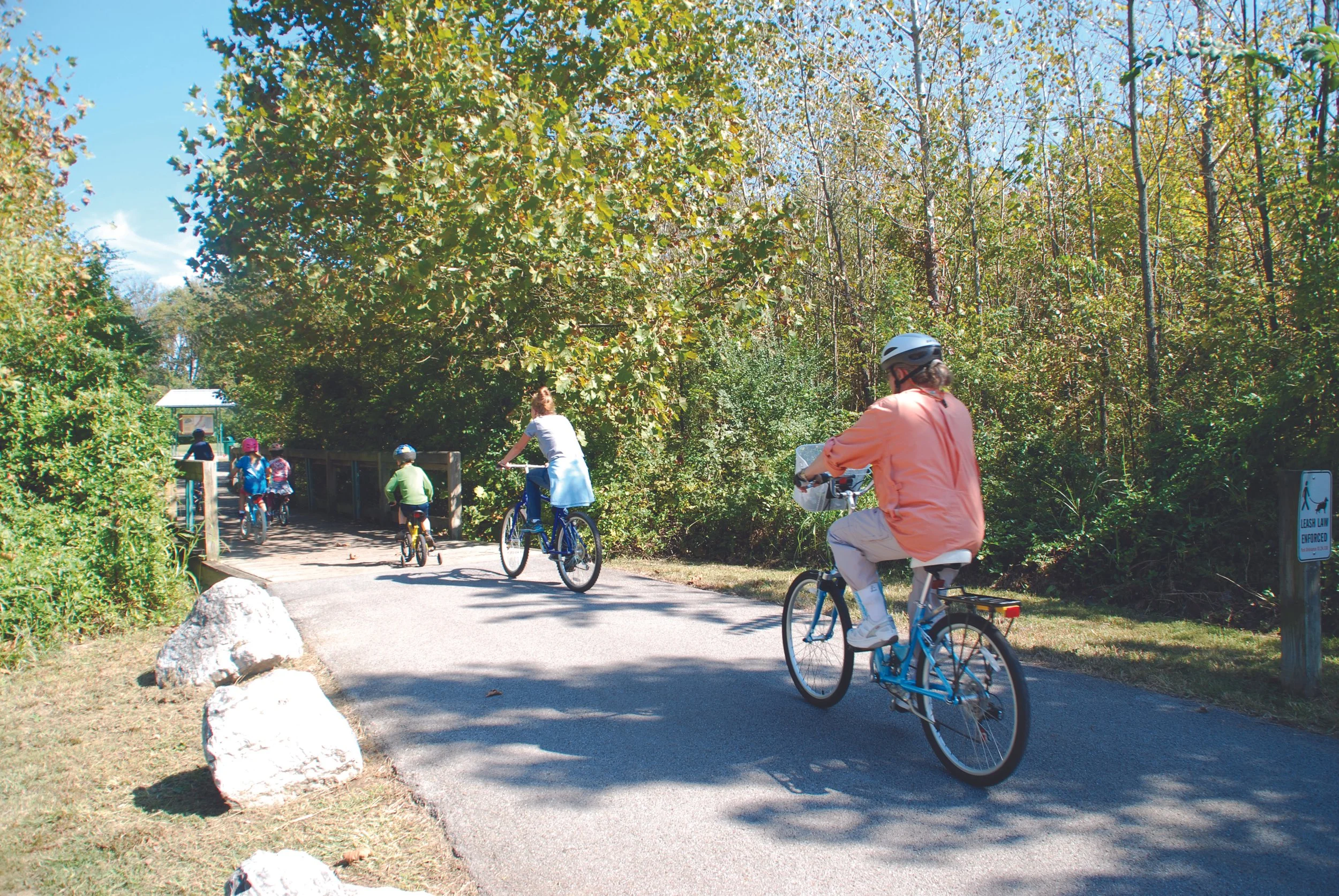
Nashville has a park deficit, as noted by Metro Parks guiding document Plan to Play, and very few safe bike and mobility lanes on its streets, which means that 64% of residents feel compelled to drive to their closest park or greenway. If our gateways to greenways were made more accessible and garnered a sense of place, we could promote active transportation, enhance quality of life, and support economic development.
This project supports our Guiding Principles for Health-Promoting Features, Celebrating Streets and Parks + Greenways. Check out the Guiding Principles to learn more about our goals.
Multimodal Plan of Nashville
The Multimodal Plan of Nashville is a mobility framework inspired by The Plan of Nashville, aimed at enhancing connections within urban neighborhoods. By prioritizing advocacy for the city’s core mobility network—including existing initiatives like Choose How You Move All Access Corridors, planned + logical urban greenways, and key WalkNBike connections—this framework establishes a foundation for surrounding communities to seamlessly link into and navigate the urban system in the future.
Project Precedents
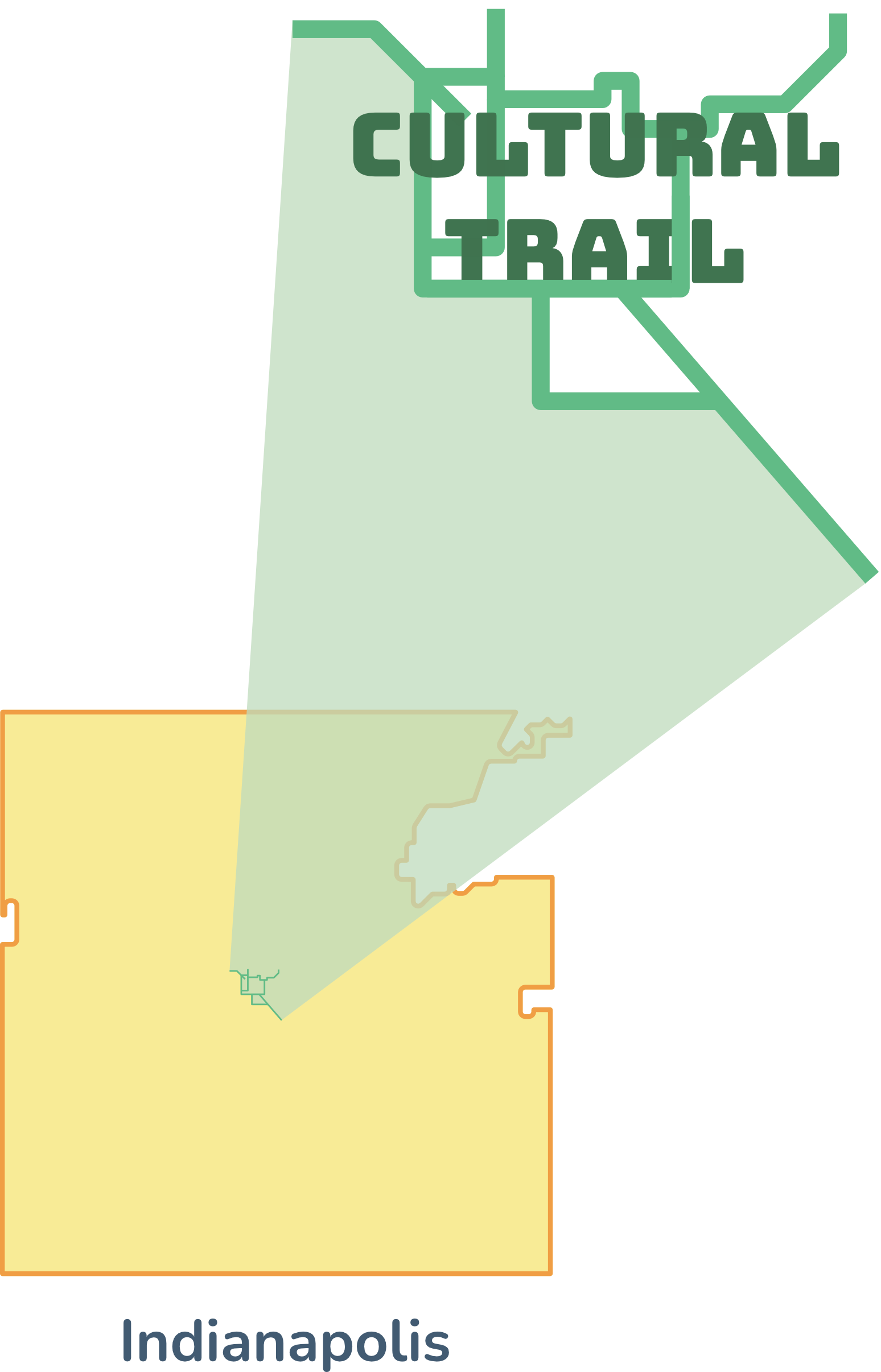
Indianapolis Cultural Trail
10 miles of on and off-road trail
Large-scale programming
Operates docked bikeshare
Comprehensive public art plan
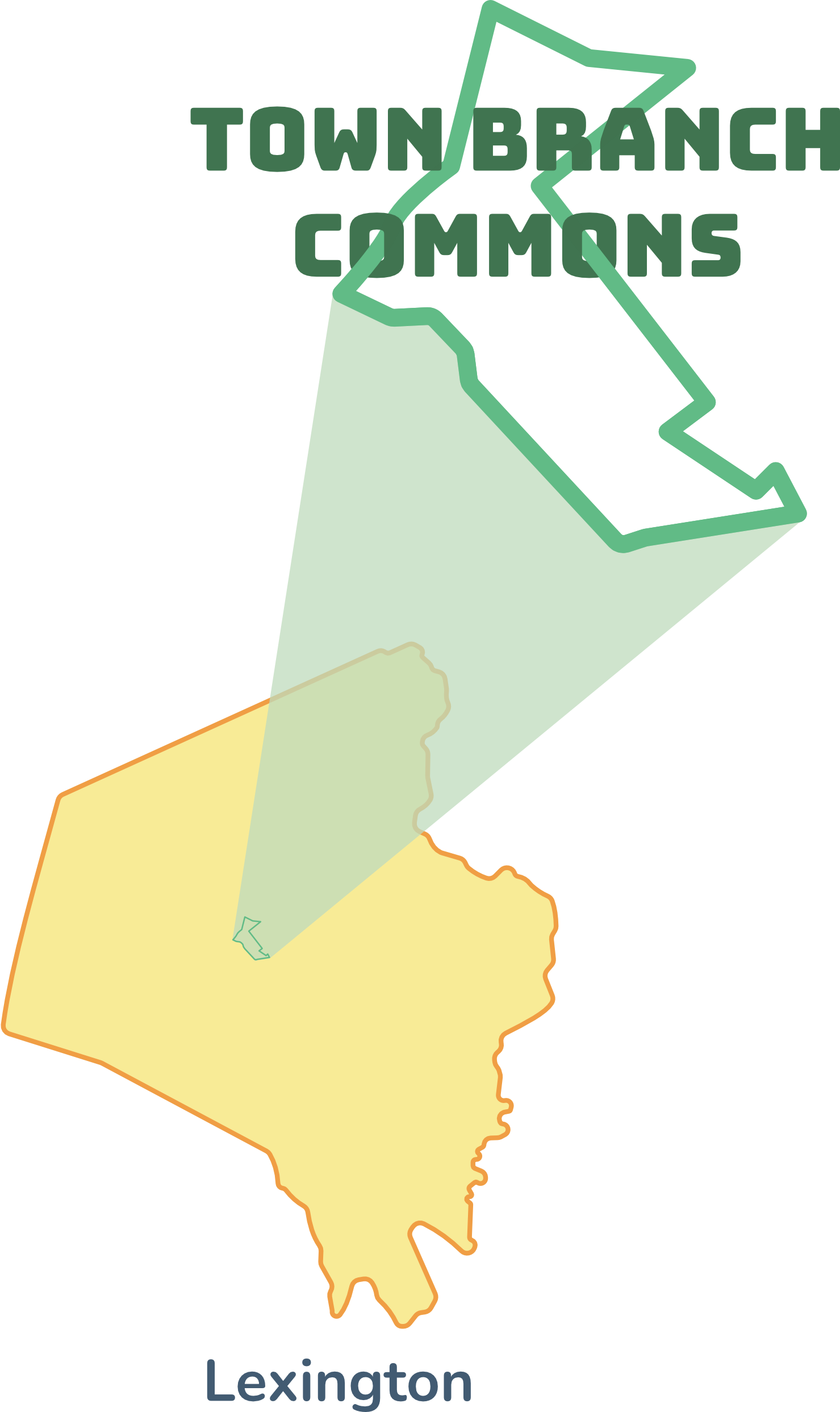
Lexington Town Branch Commons
Connects 22 miles of paved trail
Brand new, well-activated park
Major placemaking and history efforts
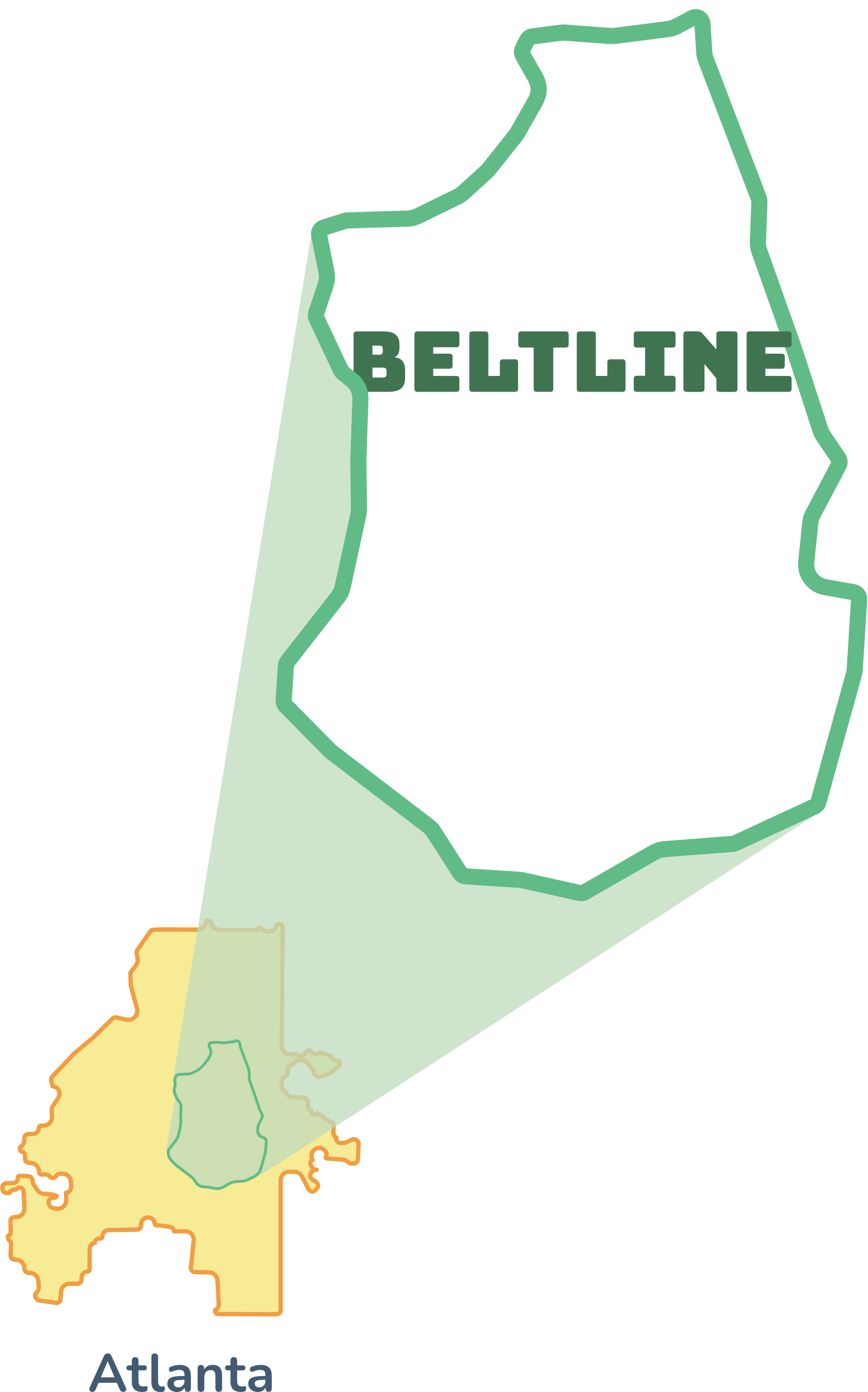
Atlanta Beltline
20 miles of paved trail + parks
Large-scale programming
Trail-oriented development
Dining, retail, wellness, + art
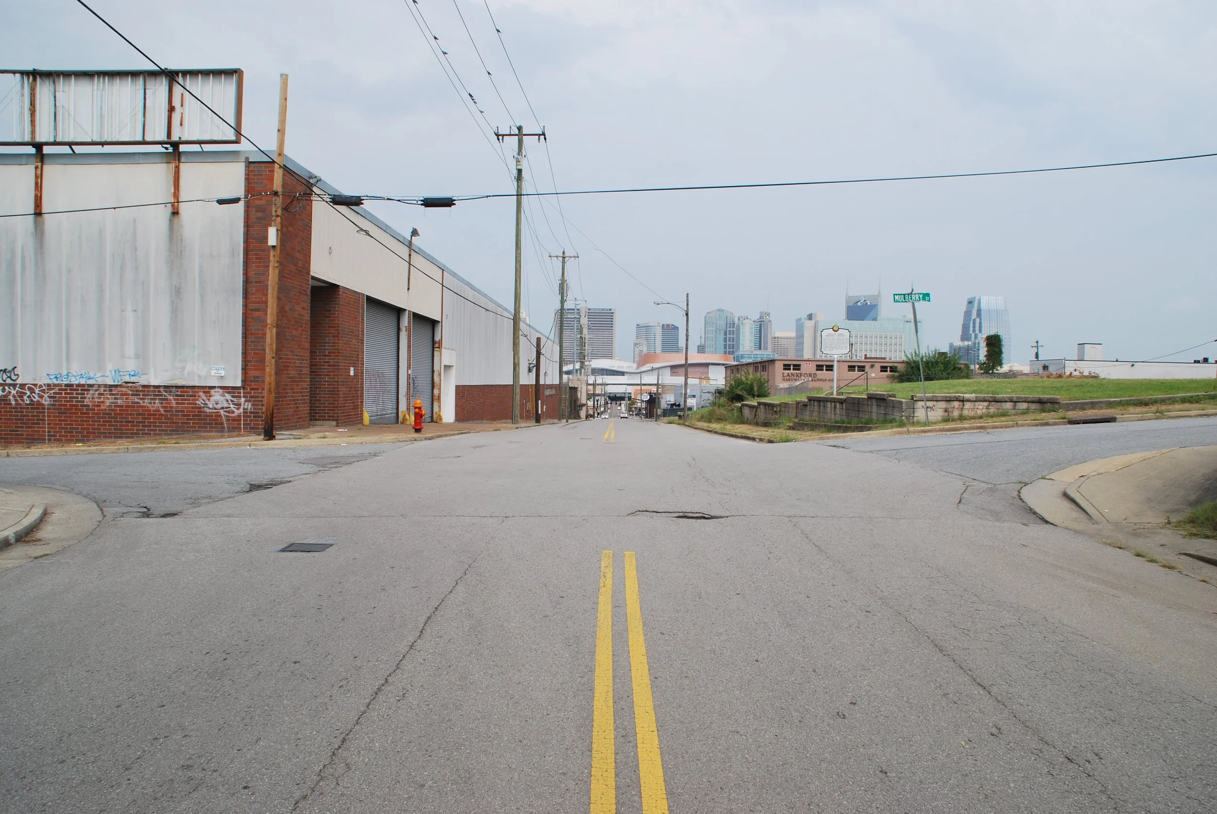
Phase 1: Focusing on South Nashville
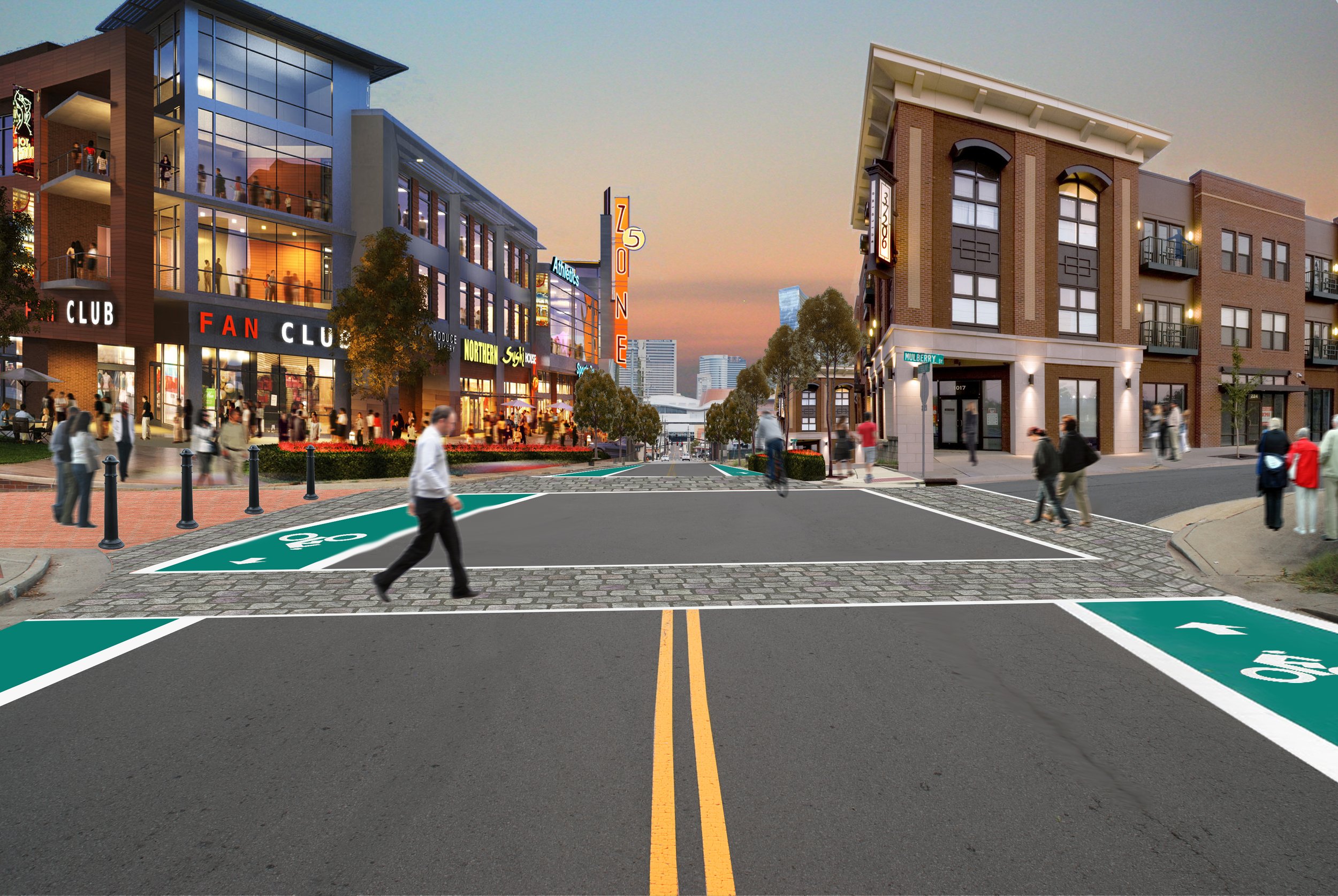
2-way cycle track concept sketch looking north on 6th Ave toward the Music City Center
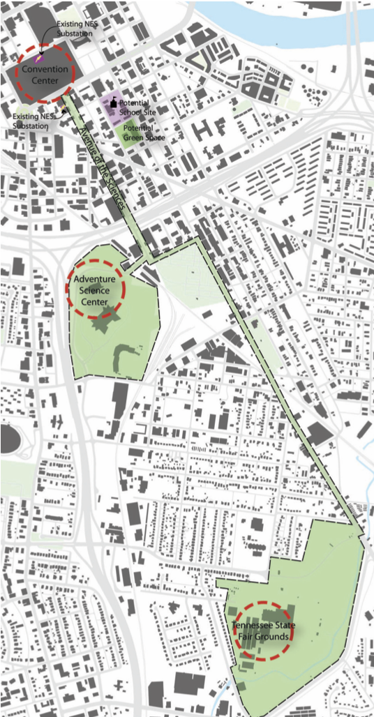
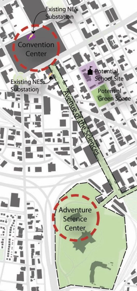
Schematic concepts for the path of Avenue of the Sciences as demonstrated in 2009 Civic Design Center Case Study
Concept for closing Lee temporary to test a small public plaza
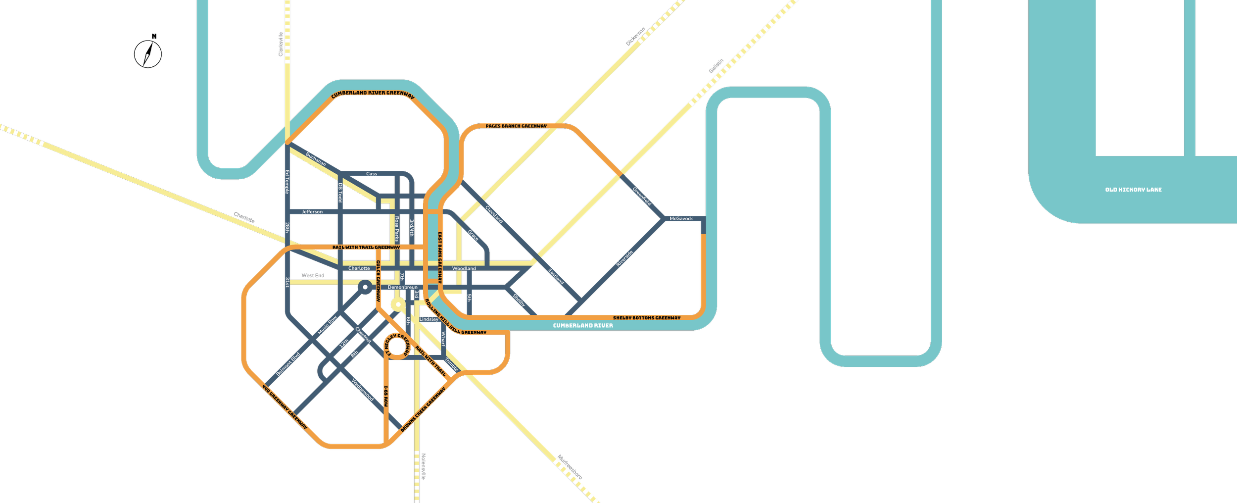
South Nashville has the greatest greenway deficit in the CityCentral system, but there’s more on the horizon! To complete a 7-mile greenway plan from Centennial Park to Browns Creek, the Tennessee Department of Transportation (TDOT) is allowing the 440 Greenway to be built on TDOT right-of-way adjacent to the 440 interstate loop. This will be a pivotal connection for the CityCentral Greenway and provides a catalyst for further greenway connections into Downtown from South Nashville.
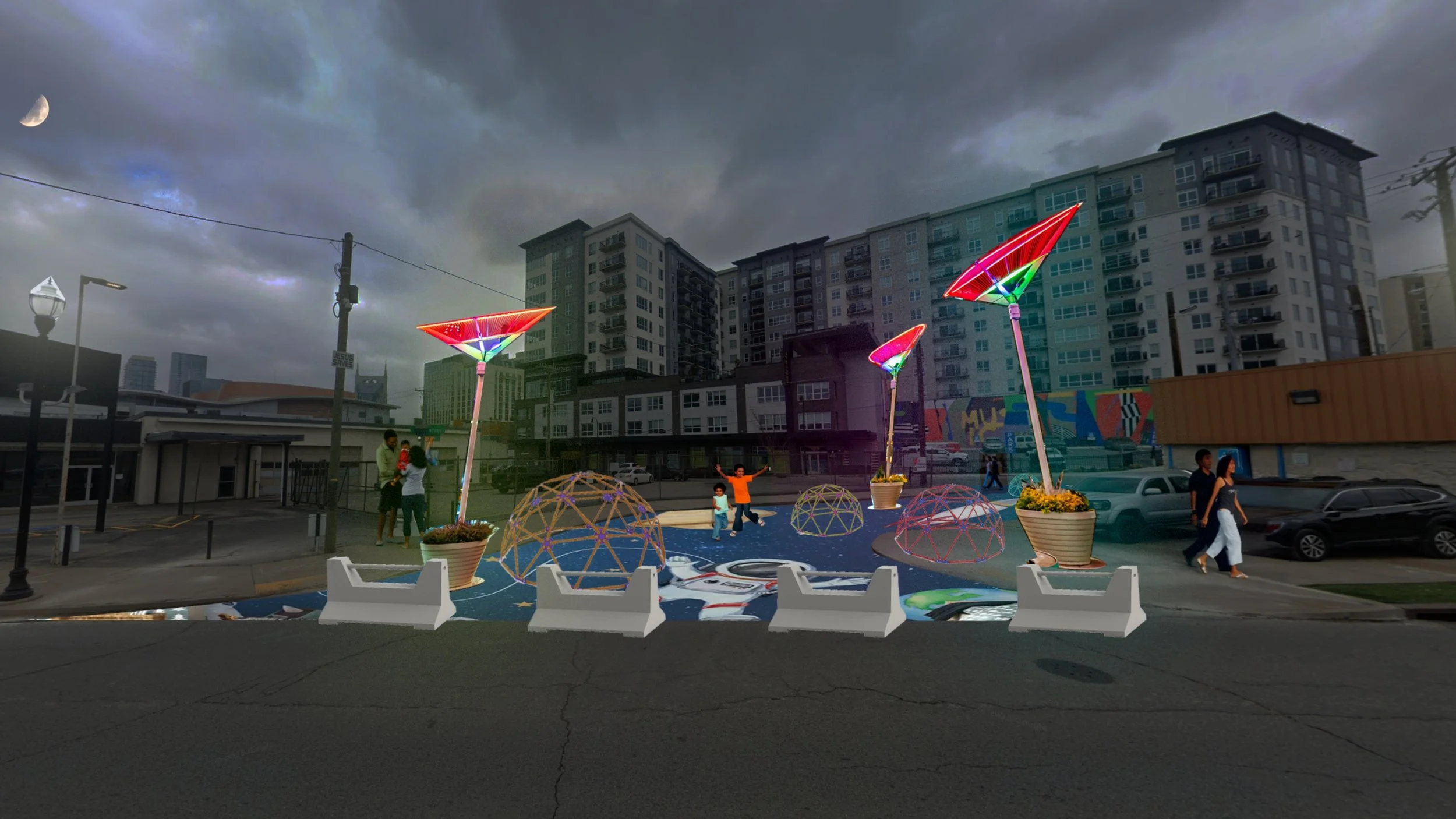
Dating back to 2009, the Civic Design Center studied a placemaking corridor devoted to science education that would stretch from the Fairgrounds to Music City Center—dubbed the 6th Avenue of the Sciences. 6th Avenue S is a critical multimodal path outlined in both the Connect Downtown Plan and the WalkNBike Plan that would extend existing mobility lanes from Lafayette to Demonbreun Downtown, but there isn’t an estimated timeline. While paved greenways take time to implement, we can use tactical urbanism methods to test on-street gateways to greenways, like 6th Avenue S.
For our proposed tactical urbanism installation between Lafayette and Korean Veterans Blvd, we hope to implement dedicated mobility lane for bicycles and micromobility, expanded pedestrian space, traffic-calming design elements, public art and lighting installation, and science-themed placemaking features that will encourage people to stop and learn as they walk or bike along the Avenue.
Another key opportunity for scientific placemaking would be closing Lee Avenue between Lafayette and 6th Ave to vehicles. Reimagining this space could allow for the creation of a small public plaza, providing room for installations and pedestrian activity.
If you are interested in learning more about the Avenue of the Sciences, visit our blog.
Project Components


Resources

“Greenways and bikeways go hand in hand with public transportation, and greenways can act as transportation corridors. Additionally, it is now apparent that communities located near greenways are more desirable for home buyers.”
— Mark Deutschmann, Core Development
Excerpt from One Mile Radius: Building Community from the Core
This project was made possible with funding support from: